
While I was writing Fourth World, I found myself really needing some maps for spacial reference, especially since I was dealing with a real planet with real geography that wasn’t instantly familiar to my brain. So I drew these to help me figure out where everything went. Originally I was hoping to have maps to include at the beginning of the book to help readers as well, but my map-drawing skills suck and I couldn’t afford to hire a real map-maker to make them pretty. Maybe someday that will be achievable, but for the time being, I thought I’d share my ugly little maps so readers at least have kind of an idea what I’m talking about in the book.
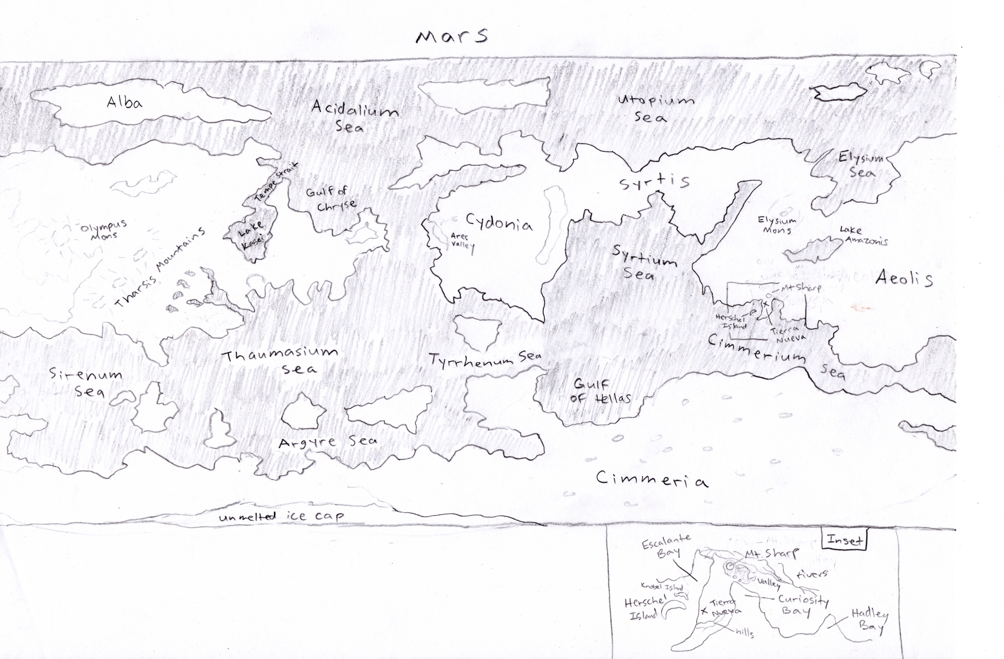
This first map is of the entirety of Mars, terraformed. I used a map of Real Mars as my guide, as well as some diagrams I found online indicating a best-guess of where waterways might be located.
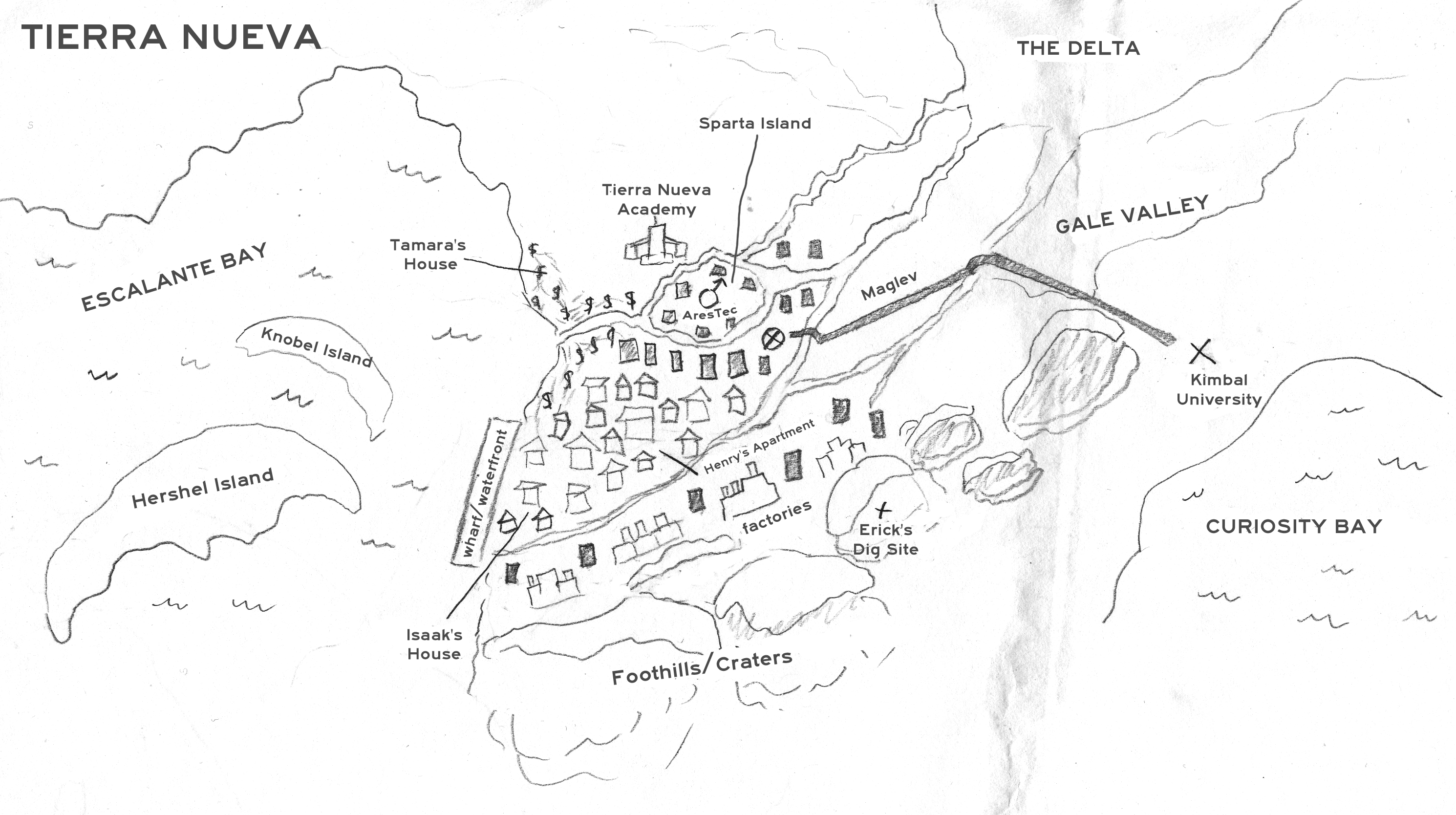
This next map is of the peninsula and specifically Tierra Nueva, the city where Isaak lives. Sorry about the big gray smear, I spilled Kool-Aid on it before I could scan it (yes, really).
Finally, the thing that made me throw everything into the fire sobbing because it looks like a middle school art project and not at all like the cool color map I’d envisioned showing to the world: Iamos.
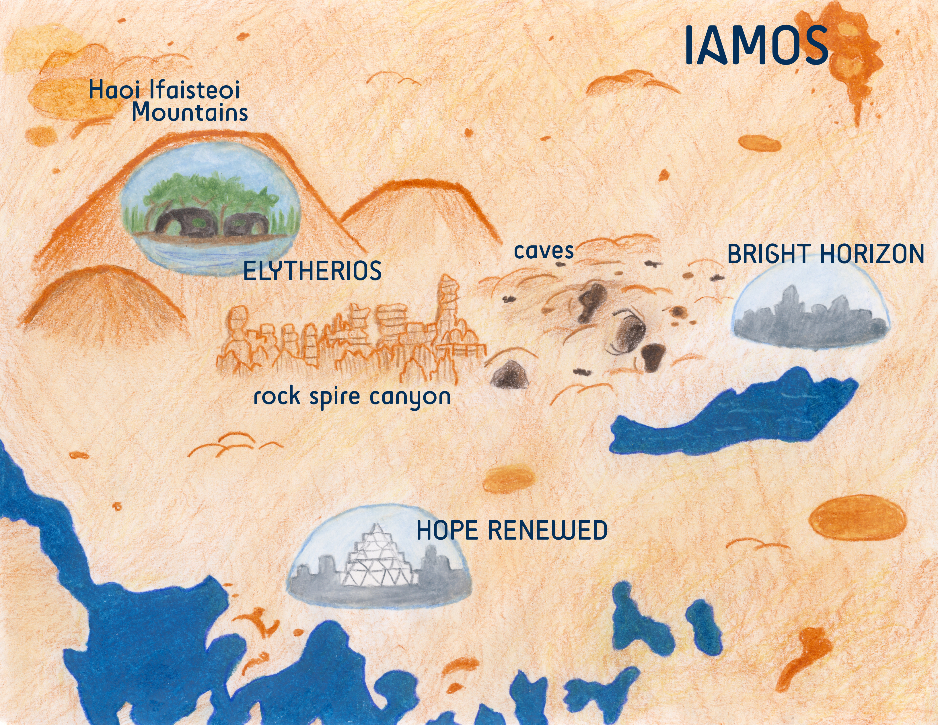
Yes, I know, it’s hideous. Please forgive me.
Anyway, there you go. Hope that these give you a better idea of where everything is located in Fourth World!